| Flying |
the Beach Patrol
By John
“Wingnut” Hazlett
 One
of my favorite trips to take in a small plane is one we call “the
Beach Patrol”. I’ve mentioned this route before (in Bob's
85th B-Day Flight ), but realized I hadn’t put any pics up on the
site yet, so I figured I’d include some here. One
of my favorite trips to take in a small plane is one we call “the
Beach Patrol”. I’ve mentioned this route before (in Bob's
85th B-Day Flight ), but realized I hadn’t put any pics up on the
site yet, so I figured I’d include some here.
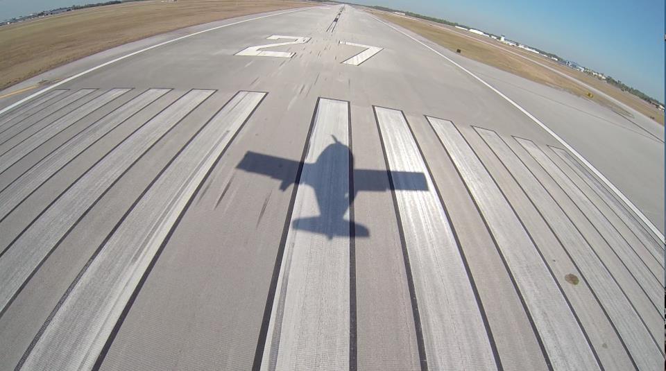
The Beach Patrol is
a box shaped route that takes us out of Peter O’ Knight (KTPF) airstrip
and out over the Tampa Bay, toward Apollo Beach. Since this area is under
TPA’s 1200’ ring, our flying is kept at about 1000’.
From this altitude, you can see down into the water very clearly. It’s
not uncommon to see large schools of game fish, dolphins, manatee’s
and sharks. I’ve been on final and passing over a small group of
prams, and looked down to see sharks underneath them that were longer
than their boats!
After reaching Apollo Beach,
I follow the coast of the Bay around to the South, then eventually to
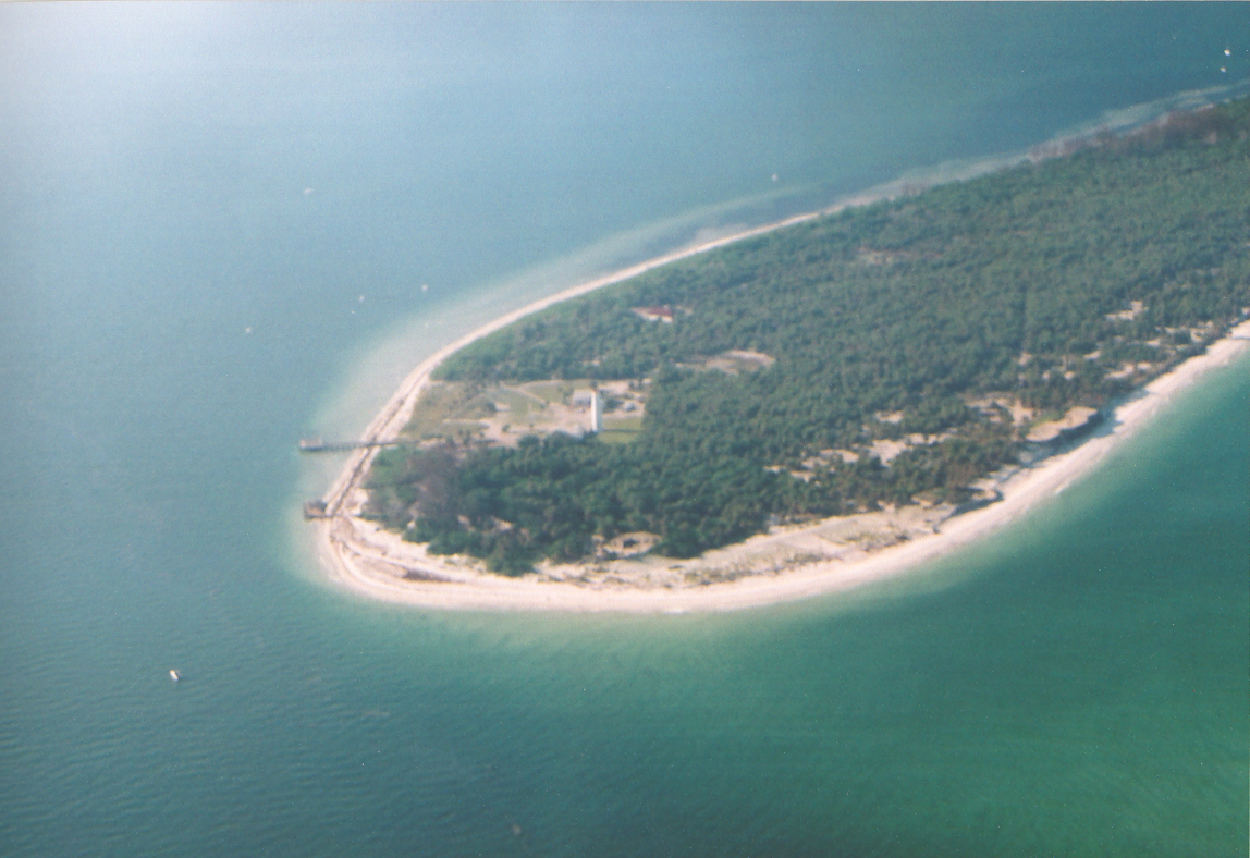
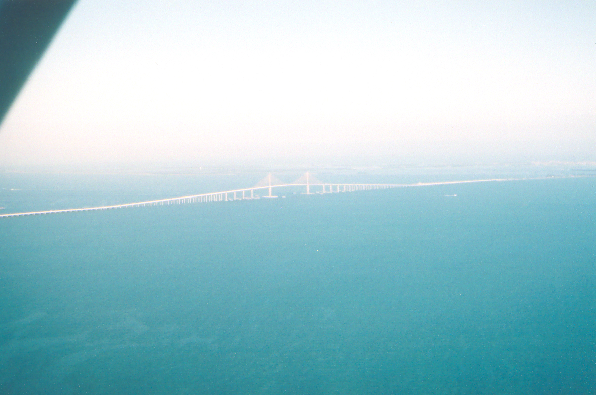
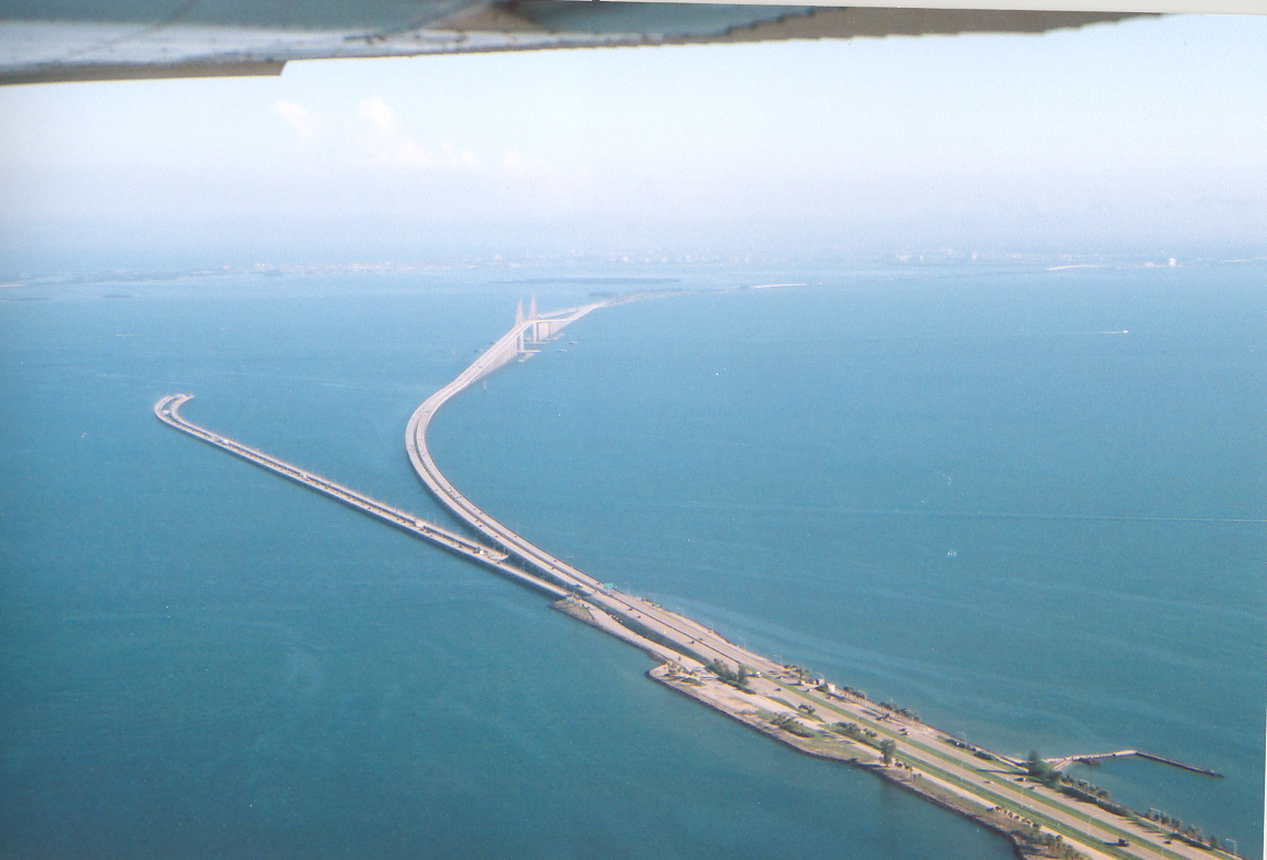
the West, over Ruskin and then Anna Maria Island. From there, I go over
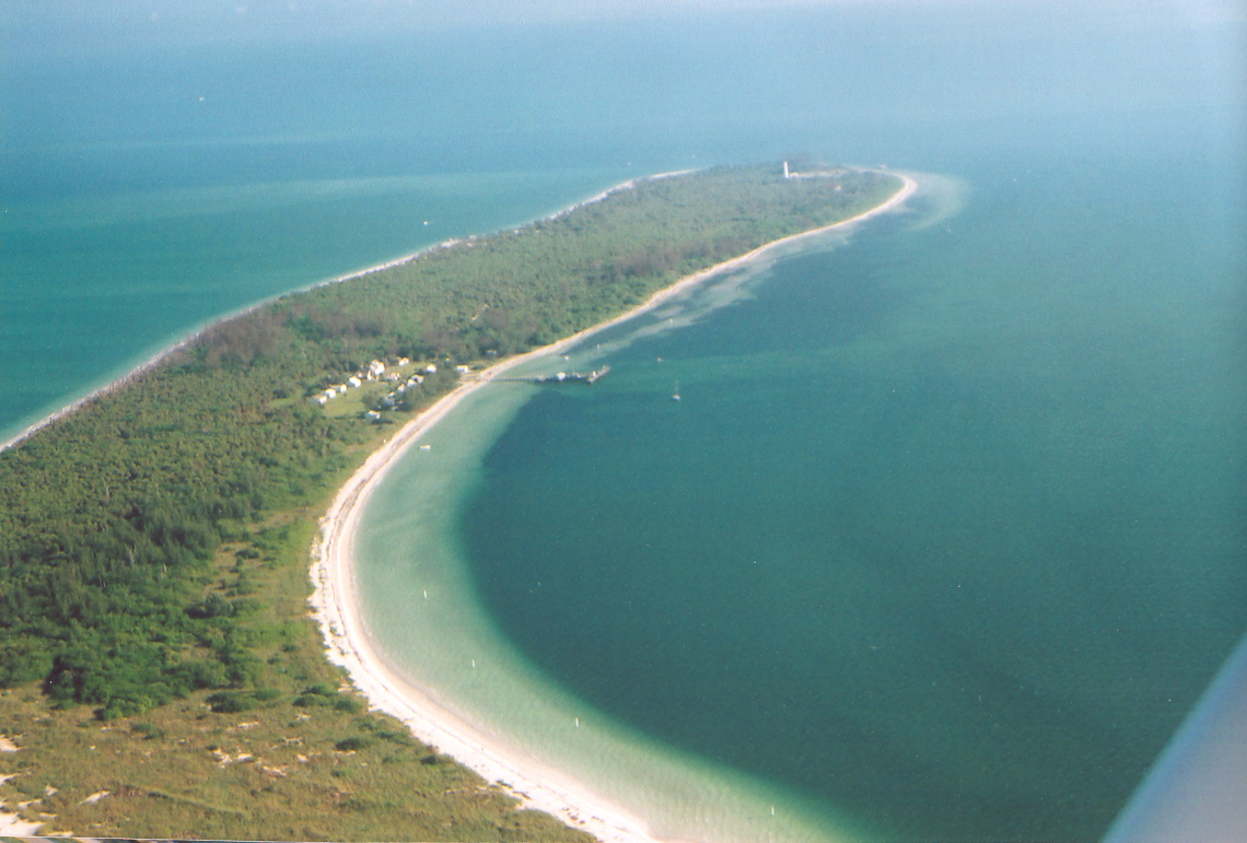
the skyway and then over Eggmont Key. Eggmont has a small B&B on it
that is only accessable by boat or float plane. Since I don’t fly
float planes (yet), we never land there. The view looks fantastic though,
and some day I’d like to stay there and relax for a while.
Eggmont is right across
the mouth of the Bay from the St. Pete beaches, and DeSoto State Park.
The water there is a greenish blue that is usually very clear so that
you can see right down to the bottom through it. At this point, you can
stay a little offshore and go up to a couple thousand feet if you want,
but I usually like to stay down low to see everything better. There are
always jet skiers and boats in the water there, and people walking on
the beach, etc. I like to fly this stretch from South to North, because
it puts my passengers on the beach side. Looking out over the Gulf on
the west side can be a little disconcerting until you are used to it.
This is a great stretch of beach to sight-see over. It eventually becomes
St. Pete Beach, and John’s Pass, and it’s always interesting
to see all that development perched right on the water, etc.
During all this way,
you are staying just outside of TIA’s outer ring, Albert Whitted’s
out ring and St. Pete/Clearwater International’s outer ring, as
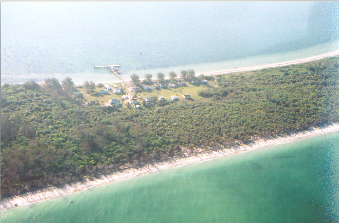
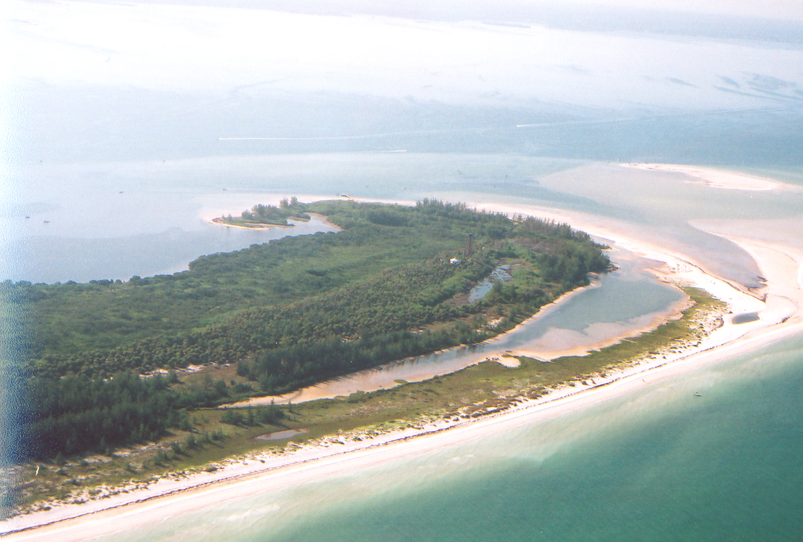
well. When we get to Anclote Key, it’s time to turn inland again.
Anclote is a bird and wildlife sanctuary, and has one lonesome lighthouse
and some pristine beaches. The water around Anclote is almost always very
clear and blue. It’s not far offshore, so smaller boats and jet
skis like to go out there and party. This entire stretch of the trip gives
us a perfect view of the intra-coastal waterway that runs down the middle
of this finger of land between Tampa Bay and the Gulf of Mexico. I usually
use a pair of tall antennas to determine when to turn, and then follow
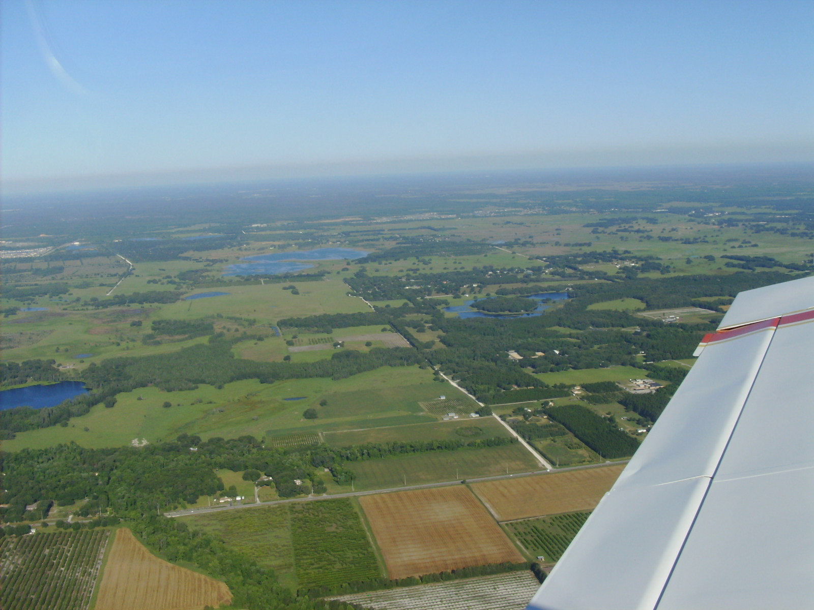
Hwy 54 across the bottom of Hernando County, heading East toward Zephyrhills.
This route takes us over the old Tampa Bay Exec field (now closed for
development as a mall) and Pilot Country Airport, which is a fly-in living
community. Then we go across I-75 and turn South over Zephyrhills. Once
we turn South, we fly over New Tampa, Tampa and then Brandon on our way
back down to Davis Island (home of Peter O’). For some reason, it’s
ALWAYS bumpy over Brandon!
When we get to Brandon,
I like to angle over toward South Tampa and Davis Island, where we’ll
be checking the wind situation and deciding which runway we’ll land
on. Peter O’ is a non-towered airport, so you’re on your own
there. The longer of the two runways is about 3000’, while the other
is slightly shorter. Most of the planes that I fly can land comfortably
within this distance, but it’s a different ball game landing on
an island, to be sure. Coming in over water can change the way your plane
is performing at unexpected times. For example, if there’s a pretty
good thermal coming off the water near the end of the runway, you may
be angled for a perfect descent until you clear the shore, when you suddenly
find that you just lost 60-100 feet. Or, the wind may be strong but steady
out over the water, only to turn turbulent as you come over the land,
etc. But I learned to fly here, and am very comfortable with the setup
– not to mention the short runways that end in water at both ends,
etc.
 At
this point, we’ve made an entire box pattern, and never had to fly
back over the same ground twice. That’s one of the best things about
this route! Also, we got to fly low and slow over the beaches, see some
beautiful islands and do a little cross-country work from Zephyrhills
(KZPH) back down to Tampa. All in all, a very well-rounded trip that usually
offers at least a couple of good photo ops. Give it a try sometime, you
won’t be disappointed! At
this point, we’ve made an entire box pattern, and never had to fly
back over the same ground twice. That’s one of the best things about
this route! Also, we got to fly low and slow over the beaches, see some
beautiful islands and do a little cross-country work from Zephyrhills
(KZPH) back down to Tampa. All in all, a very well-rounded trip that usually
offers at least a couple of good photo ops. Give it a try sometime, you
won’t be disappointed!
Fair
winds and blue skies,
Wingnut
|
|